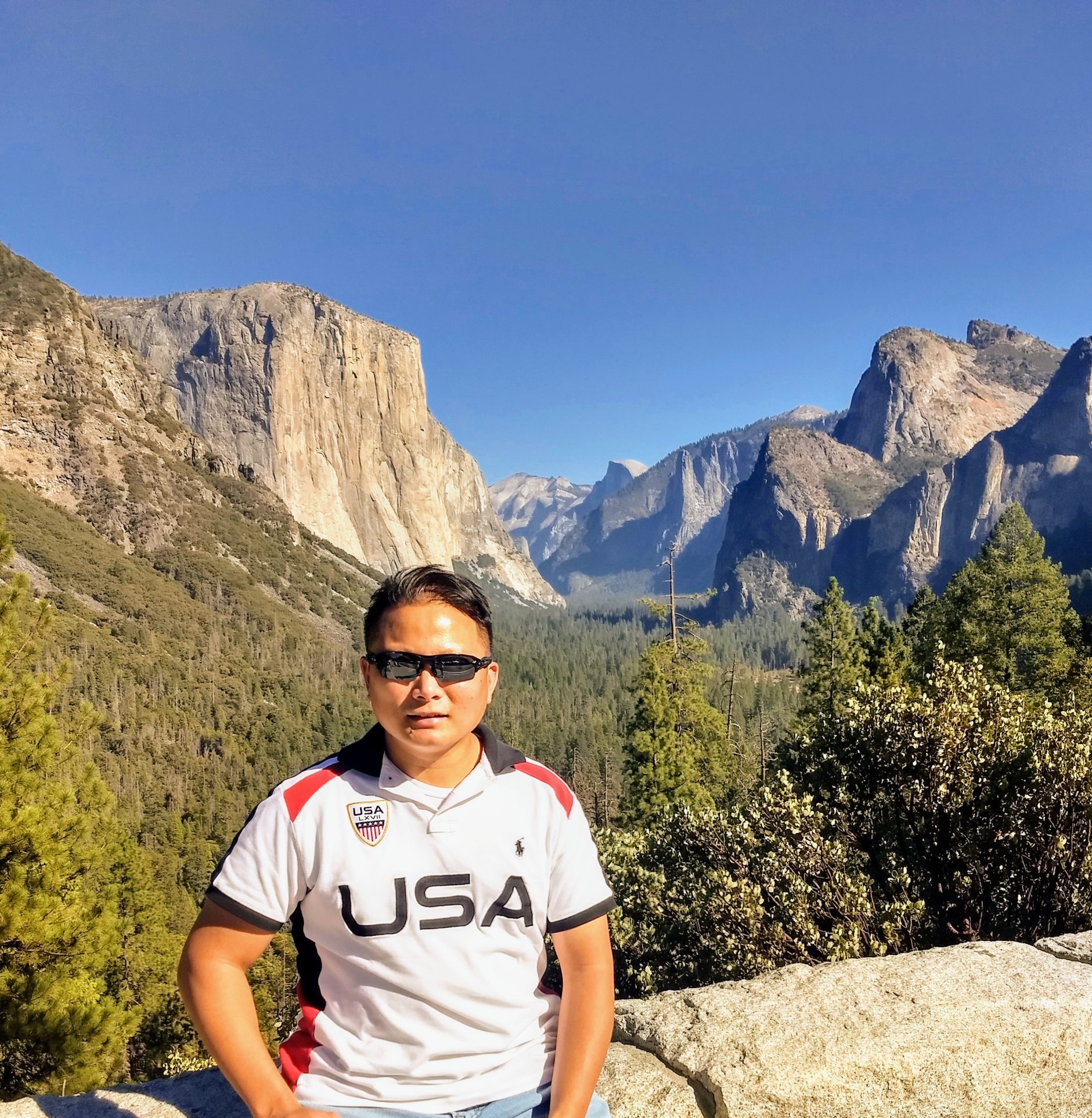
Nojoqui Falls Park

Spread the love

Address: 3250 Alisal Road Goleta, Ca. 93117.

The Nojoqui Falls Park is located in Santa Barbara County. The beautiful park features the Nojoqui Falls, ball fields, BBQ grills, picnic tables, and public restrooms. The park also offers reservable picnic tables/areas for larger groups or corporate gatherings. It is about 15 minutes away from the town of Solvang.

From Solvang, we took US 101 South and exited or turned left onto Old Coast Highway and made a left onto Alisal Road. We drove through a combination of the paved and unpaved roads for about 10-15 minutes. We even saw a nice winery and a few horse ranches along the way. When we reached the park entrance, we drove all the way up to the upper parking lot in front of the waterfall’s hiking entrance. The upper parking lot area is smaller, rough, rocky, and unpaved. But there is a clean public restroom closed to the parking area. We saw signs posted at the beginning of the hike which included “watch out for mountain lion, direction to the falls, dogs must be leashed.” Walked through the trail for about 10-15 minutes and passed through 2 short bridges, climbed a moderate uphill, and finally reached an area close to the base of the waterfalls. There were warning signs that stated “the trail is closed, keep out due to hazardous conditions such as falling rocks and landslide. Some people crossed or passed the warning signs but it will be at your own risk. There were about 40% of water falling through the falls at the time of our visit. The Nojoqui waterfall is about 80 feet and some people say the word “Nojoqui” is Chumash meaning honeymoon place.

Overall, it was a beautiful waterfall, easy hike, and a nice trail. We loved the fact that there is a closer parking area, public restrooms, a family-friendly park and lots of things to do.

Tips: Bring some bottled water and wear comfortable shoes. Last 200 feet to the falls is closed due to landslide and have warning signs. Wear your masks and practice social distancing due to Covid. It can get crowded near the waterfalls but people were giving way. Watch out for slippery rocks and trails. There is a nice winery (Folded Hill Winery) with a variety of farm animals that is near the Park.

Let me know if you have any questions and what you think about the Nojoqui Falls Park after your visit in the comments below. And kindly share our family travel blog site to your friends and family. Or even include our travel blog website address when you post your pictures on social media. Have fun and stay safe. Thank you.

Fort Ross

Spread the love

Address: 19005 Coast Hwy, Jenner Ca. 95450

In 1812, Russians established their outpost of Fort Ross in Jenner California. Fort Ross was used as an agricultural warehouse to supply Russian settlements in Alaska. Fort Ross was officially abandoned in the waning months of 1842.

Fort Ross is about 2 hours & 10 minutes drive from San Francisco via Hwy 1. We passed through a series of smaller towns such as Petaluma, Bodega Bay, and Jenner on our way to Fort Ross. From the town of Jenner, we drove for about 12 miles through a series of steep grades, sheer cliffs and lots of hairpins turns road. But the beautiful scenic view from the top of the mountain is all worth the drive.

We paid $8 as an entrance fee at the gate and drove through the paved parking area with lots of parking spaces available. We then parked our car closest to a historical huge windmill. We passed through the gift shop and walked through the trail with lots of beautiful trees which led us to Fort Ross.

As we came out from the trail we immediately saw the high walls of Fort Ross and the tower from the distance. It felt like we were back in the past at 1812. All the historical buildings were intact and well preserved. We went inside on most of the historical buildings such as the Blockhouses, Kuskov House, The Officials quarters, the Chapel, and Rotchev House. My favorite historical building was the corner tower facing the beautiful ocean with a few preserved cannons inside.

Overall, it is a great place to bring your family and learn about Fort Ross’s history and at the same time enjoy the picturesque coastal view of the ocean. There were a few picnic tables available for visitors to use.

Tips: All the historical buildings have a limit on the number of people allowed inside due to the Covid restrictions. Public restrooms are available near the gift shop. There is a trail in the back that will lead you all the way down to the beach cove with a bluish-green color of the water.

Let me know if you have any questions or what you think about Fort Ross after your visit in the comments below. And kindly subscribe, share our family travel blog site with your friends and family. Or even include our travel blog website address when you post your pictures on social media. Have fun and stay safe. Thank you

Mount Shasta Bunny Flat Trailhead

Spread the love

Address: Everett Memorial Highway McCloud Ca. 96057

Mount Shasta Bunny Flat Trailhead is about 5 hours (296 miles) from San Francisco, California via I-5 North. Bunny Flat Trailhead is one of the busiest multi-use trailheads in Mt. Shasta. It is situated on the Southside of Mt. Shasta and lies at 6,950 feet. The road to Bunny Flat is plowed throughout the year. From Bunny Flat to the top of Mt. Shasta is about 6 miles. Mt. Shasta is about 14,180 feet and a dormant volcano.

We drove for about 20 minutes from Mt. Shasta Resort where we stayed overnight. We arrived at the parking area of Mt. Shasta Bunny Flat Trailhead at 9 am. Our drive up to Mt. Shasta via Everett Memorial Highway was challenging and exciting as we had to go through an uphill ascent with a curvy and winding road. So, we had to drive slower and carefully as we are not familiar with the road. There was a lot of snow on the side of the road as we got closer to the top. We stopped at John Everett Vista Point and took lots of gorgeous pictures of the Valley including Lake Siskiyou. From Vista Point, we drove for another 10 minutes and finally reached the parking area of the Bunny Flat Trailhead.

My daughter’s eyes lit up as she saw lots of snow and kids playing on the trailhead. We also saw a public restroom and a Park Ranger information center available on site. We all enjoyed and threw snowballs at each other with a gorgeous view of the Valley.

Overall, it was a great experience and a first for us to drive up to Mount Shasta. It was well worth the drive up through the winding road. There were a lot of great spots or areas to take pictures or selfies.

Tips: Please wear waterproof hiking shoes and a jacket to prevent you from slipping and keep you warm. Protect your eyes from the sun’s rays by wearing sunglasses. Drive slowly and easy on the brakes as you drive downhill. There were a few turnouts along the way. The hike up to the top of Mt. Shasta from the Bunny Flat Trailhead is about 6-7 miles one way depending on which route do you take.

Let me know if you have any questions or what you think about Mt. Shasta Bunny Flat Trailhead after your visit in the comments below. And kindly subscribe, share our family travel blog site with your friends and family. Or even include our travel blog website address when you post your pictures on social media. Have fun and stay safe. Thank you.

River’s End Restaurant and Inn

Spread the love

Address: 11048 CA-1 Jenner, Ca. 95450.

Located in Jenner California which is about a 2 hours (84 miles) drive from San Francisco, California. The restaurant and Inn were originally built in 1972 to service the loggers and fishermen. The restaurant is situated and perched on a bluff where the Russian River and the Pacific Ocean meet.

Our experience is only for the River’s End Restaurant and not for the Inn. From Bodega Bay we drove through a series of narrow, curvy winding roads with a beautiful view of the coast. We then passed and crossed through the Russian River Bridge which is about 10 minutes away from the restaurant. After the bridge, we proceeded to the left side of the road going to Jenner Beach as the right side will lead you to the town of Guerneville. Once we arrived at the River’s End Restaurant we noticed that there were only a few parking spaces (about 10-12) available in front of the restaurant. The person that took our order informed us that they don’t serve indoor as of now due to Covid-19 and minor renovations. We then ordered our food thru an “order window” in front and we’re escorted in their back patio deck with a gorgeous view of the Pacific Ocean and the Russian River. We ordered fish tacos, chocolate mousse, and a Bloody Mary drink for my wife since we already had lunch in Bodega Bay. Our order came in within a few minutes and the fish tacos were so good and came with 3 medium-sized pieces per order. We ate and enjoyed our food on the outside patio while we watched the gorgeous view of the ocean and the river. They also have a bar and clean public restrooms available inside. We only stayed for about an hour to give other customers a chance to use the patio deck as they were very busy that day.

Overall, the River’s End Restaurant is a very cozy, romantic, and beautiful place with a gorgeous view of where the Pacific Ocean and the Russian River meet. The lunch prices menu were reasonable with average portions. Also, the River’s End is famous for its amazing sunset views during dinner time.

Tips: You can drive for a few minutes to the Goat Rock area and Jenner Beach. You can see the view of the Arch Rock stone from a distance while you visit the Harbor Seal Nursery area in Jenner Beach. But watch out and be careful of the high tides and strong surf. They have public restrooms available on both Jenner Beach & Goat Rock.

Let me know if you have any questions or what you think about River’s End Restaurant after your visit in the comments below. And kindly subscribe, share our family travel blog site with your friends and family. Or even include our travel blog website address when you post your pictures on social media. Have fun and stay safe. Thank you.

McArthur-Burney Falls Memorial State Park

Spread the love

Address: Burney Falls, 24898 Hwy 89 California 96013

Burney Falls is a 129-foot falls and the most beautiful and breathtaking waterfall. It is about a 5 hours drive from San Francisco and it’s located in Shasta County. Burney Falls is located inside Mc Arthur State Park. Parking day use is $10 per vehicle and it includes a trail map. We arrived at Burney Falls at around 9:30 am and there were a lot of parking spaces still available. There were a few parking spaces that are paved which are located after passing the park entrance and in the back area near the public restrooms and gift shop. While the rest of the parking areas are made up of dirt and gravel. We visited Burney Falls twice once in Aug. 2020 and May 2021.

We parked behind the gift shop and the public restrooms. We walked for about 10 minutes to the entrance of the falls. We took the paved downhill trail on the right side and walked for about 10 minutes which led us to the bottom of the waterfalls. There were a lot of photo opportunities along the trail. Once we were on the bottom we went through a lot of slippery, sharp rocks and a steep descent to get closer to the waterfalls. We wore our masks and tried to maintain our distance from others. There were a lot of people taking group pictures and selfie pose near the middle of the waterfalls. We felt the waterfall mists when we were closer to the waterfalls and the water is cold but with a beautiful blue and greenish color.

We saw a “Falls Loop” trail sign near the bottom right of the waterfalls. We hiked thru the waterfalls loop which is about 1.2 miles roundtrip and encircles the waterfalls. There is a great photo opportunity on the first bridge with a large downed Redwood Tree in front of the River. The Falls Loop is a dirt trail that has a few switchbacks and a moderate ascend to the top. We also passed through a Rainbow Bridge before the end of our trail hike which led us back to where we started.

After our fun short hike, we purchased a Burney Falls Huckleberry jam and Twizzlers at the gift shop. There are a lot of clean public restrooms available near the gift shop store. And I highly suggest getting there earlier because there were a lot of cars looking for a parking spot by the time we left at 1 p.m. We purchased Polish hotdogs, nacho cheese, veggie burger, ice cream at the gift shop and ate it outside on one of the picnic tables. Overall, it was well worth the long drive from San Francisco and witnessing the amazing and beautiful Burney Falls.

Tips: Get there earlier before 10:30 a.m. to find parking and to avoid the crowd. Wear hiking boots, bring water bottles and a thin jacket just in case of the weather change. You can purchase hot foods at the gift shop such as a polish hotdog, nacho cheese, veggie hamburger. Raw hamburgers are available and you have to cook them yourself. Some people bring their own food as there are a lot of picnic tables available throughout the park. There was traffic on Hwy 89 when we left at 1 p.m. due to people trying to get into the park entrance but a Park Ranger was present and asking people if they were going straight or going to the park to alleviate the traffic.

Let me know if you have any questions or what you think about Burney Falls after your visit in the comments below. And kindly subscribe, share our family travel blog site with your friends and family. Or even include our travel blog website address when you post your pictures on social media. Have fun and stay safe. Thank you.

McCloud River Falls (Upper, Middle, Lower)

Spread the love

Address: Mc Cloud Falls Road, McCloud, Ca. 96057

The Mc Cloud river runs through 3 basalt rocks waterfalls and ends on a lush meadow. McCloud waterfalls have 3 areas where you can park, walk to Vista Point and enjoy the different sections of the waterfalls. The top of the falls, middle falls, and lower falls.  Each area or section has a parking space and public restroom available. The Upper falls parking area is less crowded than the middle and lower falls which are both very popular. It’s about an hour’s drive from Burney Falls by taking CA-89 North. We visited Mc Cloud River Falls twice one in August 2020 and May 2021. We only get to explore the lower and middle falls on our first visit while we explore the Upper and Middle falls section on our second visit.

We first visited and parked on the Upper Falls section and walked for about 5-10 minutes to the Vista Point with railings installed for safety. We took a lot of pictures on the Upper Falls Vista Point and my daughter even played with the cold river water near the parking area. We then drove for about 5 minutes to the Middle falls parking area and walked for about 5 minutes to Vista Point. We then walked a little further down on a narrow dirt trail that led us closer to the Middle Falls. We navigated for at least 20 minutes on the downhill trail by passing through wooden stairs, few switchbacks, a downed tree, rocks, and dirt. When we arrived at the Middle falls, we still navigated through a lot of big and slippery rocks or boulders to get very close to the waterfalls. We were lucky enough to have witnessed a few cliff divers that were jumping off from the top of the waterfalls.

During our first visit, we parked in the lower falls area. We saw a few people swimming and diving into the water from the edge of the falls. We then proceeded to hike up towards the middle falls for about 0.7 miles one way on a dirt trail. We had to pass through a campsite area, trees and followed the sign to the Middle Falls. The Middle Falls is breathtaking and has a very nice wide cascading waterfall effect. We saw a few people swimming in the cold river water.

Tips: Please wear hiking boots, bring a water bottle and hiking pole if you are hiking the trail down to the Middle Falls from Vista Point. Wear your mask and practice social distancing especially in the Middle Falls. You may bring your own food and use some of the picnic tables available around the area.

Let me know if you have any questions or what you think about The Mc Cloud Falls after your visit in the comments below. And kindly share our family travel blog site with your friends and family. Or even include our travel blog website address when you post your pictures on social media. Have fun and stay safe. Thank you.

Mist Trail in Yosemite (Vernal Falls)

Spread the love

Address: Yosemite Valley, Ca. 95389 (Trailhead starts near Curry Village)

The hike to the Mist Trail to Vernal Falls and Nevada Falls is the signature hike at Yosemite National Park. The hike from the entrance to the first bridge overlook of Vernal falls is about 0.8 miles one way (400 ft. gain) with a combination of a paved and dirt trail but a very steep and challenging trail. The hike to Vernal falls via the mist trail is about 2.4 miles roundtrip with a gain of 1,000 ft and to Nevada falls is 5.4 miles roundtrip with a gain of 2,000 ft. You have to go through 600 slippery, wet, narrow granite rocky steps to the top of the Falls. The best time to visit is during the waterfall peak season from April -June to experience the effect of the mist from the waterfalls. President Barack Obama visited the bridge with the first glimpse of the Vernal Falls in 2016.

We arrived at the dirt and rocky parking area near the entrance to the Mist Trail at around 9 a.m. We changed into our hiking shoes as the trail will be rocky, steep, and slippery. We packed bottled water, ponchos, energy bars, and a hiking pole. The parking area is near Curry Village and the Happy Isle shuttle bus stop #16. We had to pass through a bridge and made a right to the entrance of the Mist Trail. From the entrance, we hiked on a 0.8 miles very steep paved and dirt trail that leads to the first bridge with the first site or glimpse of the Vernal Falls. We had to stop consistently and rested through our ascend as we gasped for air and water break. We took a few family pictures along the way through the trail with a gorgeous view of the mountains and the rivers below. The view from the bridge of Vernal Falls is very fascinating and beautiful. There is also a water fountain refill station at the bridge that wasn’t available that day but the public restrooms were open.

From the bridge, we then proceeded to hike another 0.5 miles on a very steep trail to the beginning of the Mist Trail. After a few minutes, we arrived on a split trail, the left side will lead to the Mist Trail and the right side will lead to the John Muir Trail Loop via the Clark Pointcut off which is a few miles longer than the Mist Trail and it will also lead to the top of Vernal Falls. We proceeded to take the famous Mist Trail which was a very steep and narrow path. When we arrived at the Mist trail, there were a lot of people climbing through the granite steps. The view of the beautiful Vernal Falls, the loud roaring sound of the falls, the wet and slippery granite steps was picturesque and intimidating. We already felt the strong water mist coming from the falls at the bottom of the granite steps. We slowly ascended up through the narrow, wet, and rocky granite steps with our hearts beating quickly as we are very cautious. We took some great pictures and a short break on some areas on the stairs. We only made it to about 30% of the climb (600 steps total up to the top) and we decided to descend back as the steps are so slippery, too many people going on both ways, too much water mist and we were scared of the height. It took us about 3 1/2 hours roundtrip since we have to stop a lot to take pictures, rest to drink water, and eat snacks.

Overall, it was one memorable challenging hiking experience. The struggle, challenge, uphill descent, sore muscles, and fear of heights were all worth it. The view of the Vernal Falls, the loud roar of the falls, and the scary wet, narrow granite steps is one experience that we will never forget. There were a lot of families with little kids also climbing through the Mist Trail. We will come back again in the future to go all the way on top of Vernal falls and be well prepared for the challenge.

Tips: Make sure that you bring lots of water, snacks such as energy bars, poncho as you will get soaking wet, wear good reliable hiking boots to prevent ankle sprains or slips, a First Aid Kit, and hiking poles. Don’t do anything unsafe and out of your comfort level. There were a few deaths relating to people slipping or falling in the river and ending up getting carried over by the strong current. Safety first in mind and wear your masks, social distancing is hard to implement on the granite steps as they are very narrow and people go up and down on both ways. And not all steps have guard rails on the side so all you would see is the bottom of the cliff.

Let me know if you have any questions or comment on what you think about the Mist Trail after your visit in the comments below. And kindly share our family travel blog site with your friends and family. Or even include our travel blog website address when you post your pictures on social media. Have fun and stay safe. Thank you.

Capitola Beach

Spread the love

Address: San Jose Ave and Esplanade Capitola, Ca. 95010

Capitola Beach is about 1 hour and 30 minutes from San Francisco, California via I-280 South, Ca-17 South (Santa Cruz), and Ca-1 South (Watsonville). You can also take Hwy-1 to Santa Cruz which is a scenic route. Ca-17 towards Santa Cruz has a lot of uphill and downhill and is a very winding road. Capitola Beach is known as the oldest beach resort on the West Coast and it is part of Santa Cruz County. It is also famous for the colorfully painted adobe houses by the beach. Capitola Beach is good for sunbathing, surfing, fishing, volleyball, birdwatching or just relaxing on the beach.

We arrived in Capitola Beach at around 9:30 a.m. on a Saturday and had a hard time looking for parking in front of the beach. So, we end up parking at an expensive parking lot that we paid a $40 fee for all day.  The parking lot was very close to the beach and behind the Britannia Arms Pub and Restaurant. Most of the parking spaces in the area were metered street parking for $1.50 per hour with a 3 hours time limit but very hard to find parking, especially on a sunny day. We were hungry and decided to eat breakfast at Britannia Arms Pub and Restaurant. We were seated outside with the view of the ocean and ordered a Traditional British breakfast, Veggie scrambled eggs, and All American breakfast. There were a lot of nice restaurants along the beach (esplanade street) with a view of the ocean such as the Margaritaville, The Sand Bar, Tacos Moreno, and many more.

There was a bridge that we walked at and end up being at the Capitola Venetian Hotel. The hotel rooms were situated close to the famous colorful adobe painted house. A few minutes away from the Capitola Venetian Hotel is the Capitola Wharf. We walked, enjoyed the ocean view, and took pictures at the Wharf. There is a nice restaurant at the end of the Wharf called “Wharf House” with tables set up outside and an amazing view of the ocean. We also noticed that there were fishing boat rentals close to the restaurant.

On our way back to the parking lot, we made a stop at the Capitola Seashells store and bought some cute souvenirs. My daughter craved for some ice cream on a warm sunny day and we end up buying a cookies n’ cream ice cream and a shaved iced drink at Souza’s which we recommend.

Overall, we enjoyed our family day walking around Capitola Beach and took a few pictures of the famous Capitola colorful painted adobe house and played on the beach. We also saw a few surfers on the east side of the beach near the rocks riding the waves and a small lagoon near the bridge that is good for little kids to play in the water.

Tips: There are clean public restrooms with a shower area close to the beach and most of the visitors were wearing a facemask due to Covid restrictions. Try to take Hwy-1 towards Halfmoon Bay on your way back to San Francisco. It is a very beautiful, relaxing scenic route with grassy fields full of beautiful colorful wildflowers and the famous Pigeon Point Lighthouse.

Let me know if you have any questions or what you think about Capitola Beach after your visit in the comments below. And kindly share our family travel blog site with your friends and family. Or even include our travel blog website address when you post your pictures on social media. Have fun and stay safe. Thank you.

Coqueta Restaurant (Tapas)

Spread the love

Address: Pier 5 Embarcadero San Francisco, Ca. 94111

Coqueta Restaurant is owned by a famous American celebrity chef that specializes in Italian California cuisine named Michael Chiarello. Coqueta offers tapas and family-style plates and drinks in a classy atmosphere. Tapas is a small Spanish savory dish typically served with drinks or a variety of appetizers served either warm or cold. Michael Chiarello is also seen on Food Network and Fine Living Network (Napa Style). He also owns the Bottega Ristorante in Napa Valley.

It took us about 25 minutes to get to Coqueta restaurant from Daly City, California. We parked our car at Pier 3 and it costs us $20 all day or a $5 per hour rate. When we arrived the friendly hostess sat us right away at the outside covered heated patio with the stunning view of the Bay Bridge. We were impressed by the prompt service of the waiters. The server reminded us to wear our masks when they are approaching our tables for Covid-19 safety. All the tables were separated 6 feet apart and have a sanitizer available on each table. We were a little bit confused on deciding what to order since it is our second time eating at a tapas restaurant. The friendly waiter suggested or recommended some of their popular dishes.

We ordered a few dishes such as the Pulpo A La Parilla which is a perfectly cooked octopus, Lubina De Mar a Mediterranean Sea Bass, Paella De Tinta a seafood paella cooked with squid ink, Croquetas De Pollo a chicken crusted with Chicharron, and fried calamari made into a sandwich with a special sauce. My wife ordered the Passion Mojito and the Galleon drinks. And for our dessert, we ordered the Churro Fantasy which is a crispy Spanish doughnut with chocolate and mixed berry powder, Manchego cheesecake with caramel popcorn, Mille Hojas de Passion a passion fruit mousse. Each dish is savory and has an average portion.

Overall, it is a very classy and unique tapas restaurant with a relaxing atmosphere and an outdoor heated patio with a gorgeous view of the Bay Bridge. We were also greeted and had a nice friendly conversation with Mr. Harry which is the General Manager. We would highly recommend Coqueta to our friends and family.

Tips: After our lunch, we walked around and took pictures at Pier 7 with a beautiful view of the Bay Bridge, Coit Tower, and Transamerica building. The restaurant is also within walking distance from the Ferry Building and the Waterfront Restaurant.

Let me know if you have any questions or what you think about Coqueta Restaurant after your visit in the comments below. And kindly share our family travel blog site with your friends and family. Or even include our travel blog website address when you post your pictures on social media. Have fun and stay safe. Thank you.

Bowling Ball Beach

Spread the love

Address: Hwy-1 and Schooner Gulch Point Arena, Ca. 95468

Bowling Ball Beach is a unique beach due to its spherical sandstone mineral cement rocks or concretions which often are visible during low tide. Bowling Ball Beach is part of the Schooner Gulch State Beach located in Mendocino County, California. It’s about 10-15 minutes away from Point Arena Lighthouse via Hwy-1.

We left Point Arena Lighthouse and drove through Hwy-1 for about 15 minutes until we saw a signage that stated Schooner Gulch State Park and proceeded to parked safely on the side of the road. We noticed that there were two trailheads from the parking area. We took the southern trail but realized that it was the wrong trail. There were a few tourists that were also lost and one of them indicated that they saw another trail near the parking area. Everyone went back and proceeded to the other short trail (northern) with wooden stairs that led us down to the beach. As we went down to the beach, we had to navigate safely through some big logs, tree branches, and seaweeds that were blocking the beach access. From the entrance, we saw all the huge round or oval-shaped rocks from the distance.

We were lucky that it was a low tide that made all the large round-shaped rocks visible that resemble bowling balls. There were seaweeds and slippery rocks that we saw as we navigated through the beach. We took a lot of beautiful pictures of the unique large oval rocks with the ocean and the mountain as our background. There were also a few tidepools and nice rock formations at the beach.

Overall, we enjoyed, loved our experience and it was a short hike to the beach but a challenge navigating through the big logs and branches. Before our trip, we checked on the tide chart for the low tide times. We found out that the northern trail is sometimes closed due to erosion where it descends the bluff. Always be careful while descending through the wooden stairs and keep an eye on the ocean waves for safety.

Tips: We saw a small waterfall on the southern trail that led us to the Schooner Gulch State Beach. Fyi, Schooner State Beach is located before a small bridge and you have to park your car facing south. There is no public restroom or porta-potty in the area and wear comfortable walking or hiking shoes.

Let me know if you have any questions or what you think about Bowling Ball Beach after your visit in the comments below. And kindly share our family travel blog site with your friends and family. Or even include our travel blog website address when you post your pictures on social media. Have fun and stay safe. Thank you.