Yosemite National Park in Winter Season (Mariposa County)

Address: 7403 Yosemite Park Way Yosemite National Park Ca. 95389

Yosemite National Park is such a magical place with different places to highlight each season. But I will be writing about our first-time experience at Yosemite National Park during the winter season. Our goal to visit Yosemite this year in all four seasons is finally accomplished and checked off from our bucket list. But visiting Yosemite in the winter season is very unique and magical. We choose to visit Yosemite in winter by using a Tour Company called Incredible Adventures. We were picked up around 7 a.m. in one of the designated hotels in San Francisco by our Incredible Adventures driver/tour guide. The tour is for one day about 14-15 hours and the cost is $169 per adult and $139 for kids 12 years old and under. The tip and food are not included with the one-day Yosemite Tour package. There were a total of 9 passengers on the tour. Our travel time took us about 4 hours from San Francisco to Yosemite via Hwy 140 El Portal. And there was no ice or snow on the road in the El Portal area.

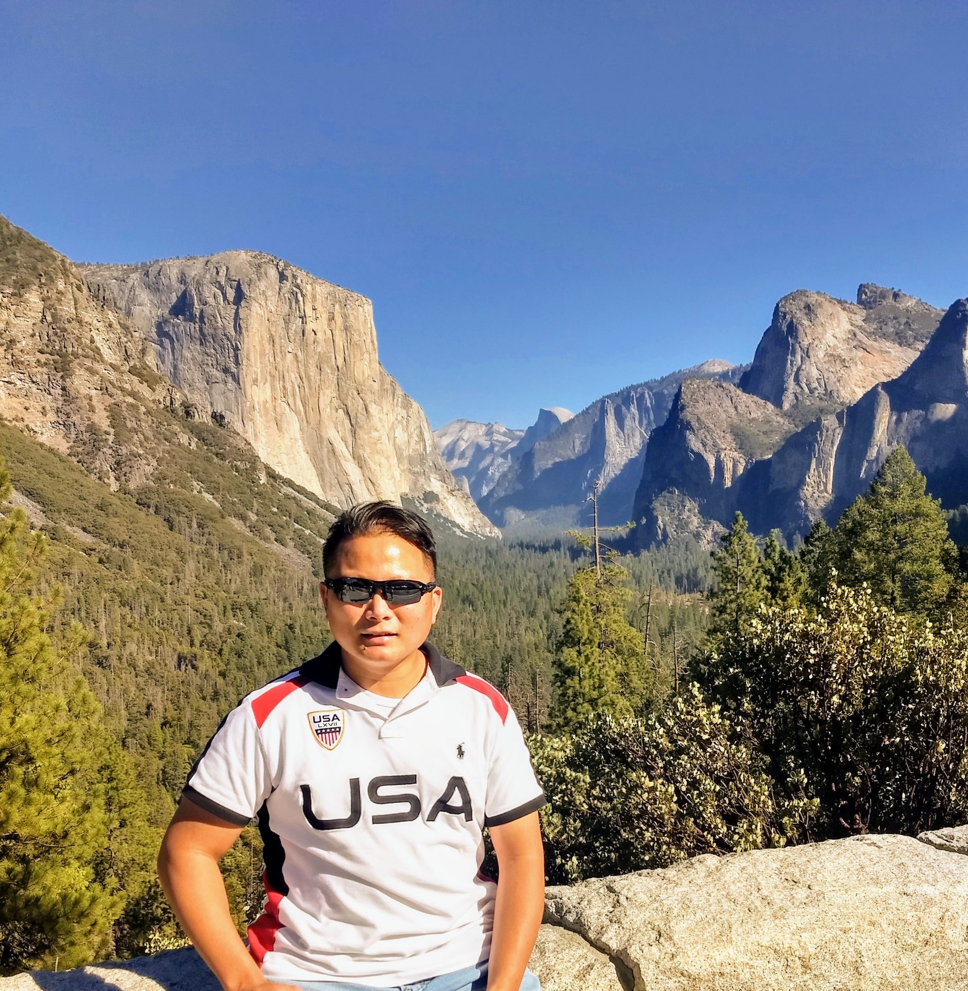
But everything changed after we passed the park entrance for a few miles and saw ice/snow on the road and on the side. The scenery suddenly changed into a beautiful mystical winter wonderland. My daughter’s eyes widened and were full of excitement as she saw all the snow on the side of the road. There were a few people on the side of the road cheerfully playing in the snow. Our first stop was the Tunnel View and there were a lot of visitors, crowded and the parking lot is full of melted slushy ice. We took a lot of great pictures with the view of the waterfalls and the valley being covered with snow as our background. We then drove through Yosemite Valley at around 1 p.m. and parked at the Yosemite Valley Market as our meeting place. Our knowledgeable tour guide/driver gave us an overview, tips, and places to explore for our 3 hours of free time. We separated with the group and explored the Lower Yosemite Falls, Cook’s Meadows, and Sentinel Bridge.

There were a lot of people at the Lower Yosemite Falls area but the amazing view of the gushing waterfalls and rocks covered with snow was well worth the effort getting there. It took us about 20 minutes to walk from the Marketplace. After the falls, we then proceeded towards the Cook’s Meadow and Sentinel Bridge. We were in awe as we saw the view of the Cook’s Meadows which was so magical and it’s like a winter wonderland. We played in the snow, threw snowballs at each other, made a snowman while my wife explored the area and took amazing pictures. What’s more interesting are the beautiful pictures that we took of both the Cook’s Meadows and Sentinel Bridge with the waterfalls and the half-dome in the background. The reflection of the half-dome in the water by the Sentinel Bridge was very serene and beautiful. The entire Cook’s Meadow and Sentinel Bridge were all covered with bright, white powdery snow. We then walked and arrived at the Yosemite Market at 4 p.m. to prepare for our departure.

We made a few stops such as the El Capitan Meadow which was another beautiful place overlooking the famous El Capitan. And lastly, our final stopped was at a popular spot called the Valley View where you would see a picturesque view of the El Capitan, Merced River, Bridalveil Falls, and the El Capitan Meadow. There were a lot of photographers gathered since it is one of the popular spots for picture taking with the entire view of the Valley. It’s also a recommended area to take pictures during sunrise and sunset with El Capitan’s beautiful reflection on the water. The Valley view is the last tourist area for taking pictures before you exit Yosemite Valley via highway 140 El Portal. We arrived at our San Francisco Hotel drop-off area at around 8:30 p.m.

Overall, it’s one of our memorable trips to Yosemite National Park as it transformed the entire park into one magical winter wonderland. Its winter scenery is like a scene from one of the famous 2005 Fantasy film movies called “Chronicles of Narnia”. We can’t wait to go back again to this beautiful, mystical winter wonderland place called Yosemite.

Tips: Always check the road conditions and weather in Yosemite via the park’s website. Bring tire chains in case it is needed and an ice trekker for your shoes to minimize or prevent you from slipping or falling due to wet ice or black ice on the road or throughout the park. For food and souvenir needs visit the Yosemite Village Store with lots of parking. Bundle up and bring gloves, scarf, hand warmers, beanie, snow pants, waterproof snow or hiking shoes, lip balm, snow jacket etc. There are ample public restrooms available in the Valley.

Things to do in Yosemite during winter: Cross-Country skiing, snowshoeing, the outdoor ice skating rink at Curry Village, snow tubing, sledding (Crane Flat area), snow playing area (near the south entrance, and strawberry near Sonora pass), stargazing, and visit the museums, etc.

Let me know if you have any questions, comments, or what you think about Yosemite National park in the winter season after your visit in the comments below. And kindly share our family travel blog site with your friends and family. Or even include our travel blog website address when you post your pictures on social media. Have fun and stay safe. Thank you.

Click here to find a hotel close to Yosemite National Park in Mariposa County.

Bodega Head State Park (Sonoma County)

Address:  3799 Westshore Rd, Bodega Bay, CA 94923

Bodega Head Trail State Park is in Sonoma County and situated on a small town called Bodega Bay. Bodega Head shelters the bay and harbor from the power of the Pacific Ocean and is about four miles long and one mile wide. Bodega Head is good for people who enjoy sightseeing, nature walking, photography, hiking, whale watching, or simply watching the sunset. Bodega Head has two trails which are family friendly and the trailhead protects both the North and West sides of the Bodega Harbor from the Pacific storms. Bodega head bluffs and cliffs have a 360 degrees views of the Pacific Ocean with the deep blue seas. There are 2 parking lots available onsite which are the upper area which is less maintained road and the lower area which is made up of sand and rocks with large potholes. There is no admission or entrance fee to visit the State Park. And no drones are allowed in Bodega Head.

The East Trail is a 1.7 mile loop that passes through the southern coastal bluffs of Bodega Head. While the west trail is a 1.2 mile loop that leads to the coastal bluffs and overlooks the view of the Horseshoe Cove. Bodega Head is one of the great spot to Whale Watch by the west trail parking area.

Bodega Head is about 1 hour and 30 minutes drive (77 miles) from San Francisco to Bodega Head State Park via US-101 North. But we came from Napa area (Yountville area) which only took us about 1 hour drive to Bodega Head. We passed through a couple of towns, local stores along the way such as the Valley Ford Cheese & Creamery, Estero Cafe, Valley Ford Supermarket. The cool place that we made a stopped over and ate is the famous “Bodega Bay Oyster Company.” We had our late lunch and ordered the famous “Kumamoto” bbq oysters, clam chowder, shrimp tacos and garlic bread.

We also passed through the popular Bodega Bay “Spud Point Crab Company” which is famous for its signature clam chowder. Bodega Head is about 3 minutes away from Spud Point. We made a right turn at the end of the road and drove up on a two-way, winding, narrow paved road. We had to be careful and paid attention to the other oncoming cars driving downhill and leaving the area. The large parking area was very busy since it was almost sunset and made up of sand and gravel with large potholes.

Overall, it was a fun, beautiful place to watch sunset with a 360 view of the Pacific Ocean with the deep blue seas. We enjoyed and experienced the power of the ocean as the waves crushed at the huge rocks and mesmerized by the beauty of nature at sunset. There were other hiking trails available at Bodega Head that you can explore with the entire family.

Tips: Watch out when you are driving uphill towards Bodega Head as the roads are narrow, slightly winding and two-way streets. Always watch out for oncoming traffic and pay attention to cars coming in and out of the parking space. There are public restrooms onsite but without a sink, so bring your toilet paper and hand sanitizer.. Bring binoculars to see all the different species of birds, wildlife and whale watching. Parking lot is made up of sand and gravel (unpaved) with large potholes. Watch out for dangerous cliffs and bring a jacket or sweater as the weather changes.

Let me know if you have any questions, comments or what you think about Bodega Head State Park after your visit in the comments below. And kindly share our family travel blog site with your friends and family. Or even include our travel blog website address when you post your pictures on social media. Have fun and stay safe. Thank you.

Click here to find a hotel close to Point Lobos State Natural Reserve Park.
Salt Point State Park (Sonoma County)

Address: 25050 CA-1, Jenner, CA 95450

Salt Point is a 6,000 State Park in Sonoma County with California’s first underwater area. Salt Point State Park is good for people who enjoy sightseeing, photography, picnicking, jogging, scuba diving, painting, and nature study. The park is famous for its coastline, strong waves, fascinating sandstone formations, colorful underwater life, and tide pools. There are a lot of different trails to choose from within Salt Point. It has 20 miles of hiking trails and over 6 miles of rocky coasts. Tafoni’s are sandstone rocks with unique honeycomb formations found in the southern Gerstle Cove area. It is open seven days a week from 8 a.m. until 10 p.m.

Typically, the drive to Salt Point is about 2 hours and 30 minutes and 101 miles from San Francisco via US-101 North and CA-1 North. But we drove to Salt Point after our breakfast at Coast Kitchen Restaurant which is about 15 minutes away. We arrived at the main gate at around 1:00 p.m. and paid the park ranger $8 for the day-use entrance fee. The Park Ranger gave us a map and instructed us to just go straight until we hit the end of the road. We accidentally made a left towards the visitor center/south Gerstle Cove area and the road was very rough, with lots of gravel, rocks, and potholes. We even saw a few deers on our way back to the main parking of Gerstle Cove State Marine Reserve. There were a lot of parking spaces and public restrooms at Salt Point Main Trailhead. From the parking lot, we walked for at least 15 minutes towards Gerstle Cove. The trail led us on a downhill path up to the Cove’s beach area. From the cliff, the water at the Cove is clear pristine turquoise water. But as we descended down to the Cove area we had to navigate through all the large rocks all over the beach. And my wife even saw a few jellyfish floating in the clear water. The Salt Point Trail is beautiful, scenic, easy, and one of the main attractions. The trail on the Salt Point area is great for nature trips, bird watching, hiking, and walking. The trail was easy and saw a few spots great for a photo opportunity. The descent up the hill from the Cove was slightly challenging.

Overall, it was a fun, easy, short, and scenic trail that is great for all ages. There were other hiking trails available that you can explore at Salt Point State Park which is strenuous or challenging.

Tips: Watch out when you are driving inside Salt Point State Park as the roads are narrow and two-way streets. Always watch out for oncoming traffic and pay attention to cars coming in and out of the parking space. There are public restrooms and picnic tables onsite throughout the park. Stay back from bluff edges and watch out for rogue waves that can sweep you out to sea. Bring binoculars to see all the different species of birds and wildlife. Watch out for dangerous cliffs and bring a jacket or sweater as the weather can get windy.

Let me know if you have any questions, comments or what you think about Salt Point State Park after your visit in the comments below. And kindly share our family travel blog site with your friends and family. Or even include our travel blog website address when you post your pictures on social media. Have fun and stay safe. Thank you.

Click here to find a hotel close to Salt Point State Park in Sonoma.

Point Reyes National Seashore

Shipwrecks @ Pt. Reyes: 12781 Sir Francis Drake Blvd Inverness, Ca. 94937

Cypress Tree Tunnel: 17400 Sir Francis Drake Blvd Inverness, Ca. 94937

Drakes Beach: 3 Drakes Beach Road Pt. Reyes Station Ca. 94956

Elk Preserve at Tomales Point: Pierce Point Road Inverness, Ca. 94937

Point Reyes National Seashore is maintained by the U.S. National Park Service and a preserved park situated on the Point Reyes Peninsula in Marin County Ca. The Point Reyes National Seashore includes headlands, estuaries, uplands, and wild coastal beaches. The preserve is very rich with shorebirds and other wildlife such as the Tule Elk at Tomales Point, elephant seals at Drakes Bay Beach, and whale watching at Point Reyes Lighthouse.

We drove for about 90 minutes from San Francisco to Point Reyes via US 101 North and Sir Francis Drake Blvd. On our way, we had to pass through a few farmlands, meadows, water reservoirs, farm animals, and a famous cheese company called Nicasio Valley cheese company. My wife bought their famous organic cheese called “Foggy Morning”.

We created our own trip itinerary which consisted of Drakes Bay Beach, Cypress Tree Tunnel, Tomales Point, Shipwrecks Point Reyes, and The Marshall Store Restaurant. The iconic Shipwrecks also called Tomales Shipwreck is an abandoned 380 ft. cargo steamship. We drove through Sir Francis Blvd and almost missed the Inverness Store which is where the Shipwreck is located at the back of the store. We purchased some snacks at the store as a courtesy since we used their parking lot to access the Shipwreck. There was an outside public restroom (porta-potty) available on site. From the parking lot, we walked for 5 minutes and saw a warning sign indicating that the property owner gives permission to visitors to pass and use the trail to access the Shipwreck area. When we arrived at the location, we didn’t realize that the ground was wet, muddy and there were a few insects present. All the visitors were courteous and we all took turns taking pictures. Most of the visitors were also wearing a mask and practiced social distancing. We took a few pictures of the Shipwreck with a picturesque backdrop. We only stayed there for about 15-30 minutes.

Our next destination was the Cypress Tree Tunnel which took us about 12 minutes (6 miles) via Sir Francis Blvd. We drove through a long road and end up parking outside on the side of the road because the gate entrance was closed due to Covid restrictions. From the gate, we were amazed by the tunnel of Monterrey Cypress Trees on the driveway leading to an old building with a radio station. My wife and I took a lot of pictures underneath the tunnel of the Monterrey Trees with the sun’s rays as our backdrop. We even walked all the way to the old building and came back. We wore our masks and practiced social distancing as there were a lot of visitors on the day we visited. My wife took great pictures and stayed there for about 10-30 minutes and drove off.

Our next destination was Drakes Beach which took us about 10 minutes (5.5 miles) from the Cypress Tree Tunnel. Drakes Beach is a remote, wide stretch of beach backed by a dramatic sandstone cliffs. We thought that we were lost since we were the only car on the road. After a few minutes, we passed through a huge meadows with lots of cows and a view of the ocean as a backdrop. We pulled over on the side of the road and took pictures of the beautiful scenery. The parking lot at Drakes Beach wasn’t crowded when we arrived. We even noticed that there was a Park Ranger on-site to enforce the rules and safety. The beach is beautiful, clean and the sand was very soft. There were families that day that were having a picnic on the beach. We only stayed at Drakes Beach for about 30-45 minutes.

Our final destination was the Tomales Point/ Elk Preserve which took us about 35-40 minutes (18.5 miles) drive from Drakes Beach. We drove through narrow long backroads with lots of twists and turns, meadows, and farm animals throughout the scenic route. During our drive, we passed through Kehoe Beach and drove after a few miles, and finally arrived at our destination. Elk Preserve at Tomales Point is also close to the famous Mc Clure’s beach. It was a beautiful sunny day and both the parking lot for the Elk Preserve and the Mc Clure’s Beach was overcrowded and full. So we had decided to just let my wife and daughter do the trail hike to see the Tule Elks while I double park and waited for someone to leave. Per my wife and daughter, the trail was long and hilly. My wife, daughter, and a few hikers saw a Coyote on top of the hill but later decided to leave. My daughter and wife told me that the trail was a moderate hike and had beautiful scenery overlooking the ocean. The experience was well worth the adventure, driving on narrow roads and crowded parking areas. I suggest coming in early in the morning to beat the crowd and find a parking spot.

Tips: We had our car tank full since there is only one gas station around the area which is located at the Point Reyes station. We ate at “The Marshall Store” Restaurant on our way going back home. They have good selections of food (crab sandwich, oysters, steamed crab, etc) and outdoor seating. We were lucky enough to have watched the beautiful sunset at their outdoor seating area. Some people ate and watched from their car in the parking lot of the bay water.

Let me know if you have any questions and what you think about Point Reyes National Seashore after your visit in the comments below. And kindly share our family travel blog site with your friends and family. Or even include our travel blog website address when you post your pictures on social media. Have fun and stay safe. Thank you

Click here to find a hotel close to Point Reyes National Seashore in Marin County.

Point Lobos State Natural Reserve (Monterey County)

Address: CA-1 Carmel By The Sea Ca. 93923

Point Lobos is a State Park in Monterey County and has often been called the crown jewel of the state park system. Point Lobos was the first U.S. marine reserve in 1960 and later became the nation’s largest maritime sanctuary. It was named “Punta De Los Lobos” or Point of the SeaWolves by the early Spanish explorers due to the fact that dozens of beaches were inhibited or crowded by sea lions. Point Lobos is about 1,315 acres of photogenic, short trail with coves, and turquoise water beaches. Point Lobos is good for people who enjoy sightseeing, photography, picnicking, jogging, scuba diving, painting, and nature study. There’s a lot of different trails to choose from within Point Lobos State Natural Reserve ( top 9 trails to hike) ranging from 0.8 miles to 3.2 miles roundtrip. It is open seven days a week from 8 a.m. until 5 p.m. There are only about 150 parking spaces divided into 9 major areas inside the Point Lobos State Natural Reserve.

It took us about 2 hours and 10 minutes drive and 120 miles from San Francisco to Point Lobos State Natural Reserve via US-101 South, CA-156 West, and CA-1 South. The route was very easy and straightaway but can get traffic or congested on CA-156 due to two lanes only. We arrived at the main gate of Point Lobos at around 8:10 a.m. and there were already a few cars ahead of us. We paid the park ranger $10 for the day-use entrance fee and proceeded to the right and followed the main road. We passed the first main parking area and proceed to make a left (look for a sign that says additional parking) that led us to the Bird Island trail parking area which is the end of the road. There were only about 10 parking spots available at the Bird Island Trail.

The Bird Island Trail is beautiful, scenic, easy, and one of the main attractions at Point Lobos It’s about 0.8 miles roundtrip and best visited from April to October. Great for nature trips, bird watching, hiking, and walking. The trail was easy and saw a few spots great for a photo opportunity. While on the trail we passed through a beautiful cove, beaches with turquoise water, and a bridge that will lead you to the Bird Island nesting rocks. China cove is where the sea lion hangs out or stays but was closed. We saw a wide variety of bird species such as Pelicans, Vultures using my wife’s camera zoom lens. We also saw a few sea otters and sea lions.

The best part of our hike is our visit to Gibson Beach which is a secluded beach with turquoise water. We made a left on a trail before the bridge and descended down towards Gibson beach. The wooden stairs that lead to the beach are very steep and have a few unstable wooden steps. The white sand beach and beautiful turquoise water were all well worth the effort. The descent up the stairs was challenging and watch your steps as the wooden handles were slightly loose.

Overall, it was a fun, easy, short, and scenic trail that is great for all ages. There were other hiking trails available that you can explore.

Tips: Watch out when you are driving inside Point Lobos Park as the roads are narrow and two-way streets. Always watch out for oncoming traffic and pay attention to cars coming in and out of the parking space. There are public restrooms and picnic tables onsite by the Bird Island Trail. Try to get there early due to limited parking space inside the park otherwise, you will end up parking your car outside by the main road and walking a few miles. You don’t need to pay the entrance fee if you are walking in but donations are highly recommended to pay for the upkeep of the park. Bring binoculars to see all the different species of birds and wildlife. They will close the main gate once the maximum capacity is reached to prevent overcrowding and safety. Watch out for dangerous cliffs and bring a jacket or sweater as the weather changes.

Let me know if you have any questions, comments or what you think about Point Lobos State Natural Reserve Park after your visit in the comments below. And kindly share our family travel blog site with your friends and family. Or even include our travel blog website address when you post your pictures on social media. Have fun and stay safe. Thank you.

Click here to find a hotel close to Point Lobos State Natural Reserve Park.

Battery Spencer (Sausalito)

Address: Conzelman Road Sausalito Ca. 94965

From 1897-1943 Battery Spencer is a vital and isolated military outpost protecting the Golden Gate. Battery Spencer is named after a revolutionary war hero General Joseph Spencer who died on January 13, 1789. It has accessible public restrooms available in the vicinity.

You have to drive through an uphill winding road in order to get to Battery Spencer. It’s about a 7-minute drive from Fort Baker via a tunnel. There is a small parking area in front with about 8-10 car spaces. If the parking in front is full you may have to park on some of the designated spots on the side of the road. There is a warning sign in the entrance that says watch out for car break-ins and don’t leave valuables inside the car. The pathway or walkway to Vista Point is made up of dirt. The Vista or Vantage Point offers amazing views of the Pacific Ocean, San Francisco Bay, the City of San Francisco, and the Golden Gate Bridge. It has so many great angles for taking pictures but watch out for your steps and restricted area. There were a lot of people taking pictures for their wedding, anniversary or just for personal keepsakes. We stayed for an hour and watched the amazing sunset. But please bring a jacket as it can get very windy and cold. There were also a few people that brought picnic blankets and food while enjoying the view. We had to use our flashlight to guide us back to the parking area as the area is dark.

Let me know if you have any questions or what you think about Battery Spencer after your visit in the comments below. And kindly share our family travel blog site with your friends and family. Or even include our travel blog website address when you post your pictures on social media. Thank you and have a nice day!

Fort Baker (Sausalito, Ca)

Address: 601 Murray Circle Sausalito, California 94965

Fort Baker is a 35 acre former Army post in 1905 and located north of the Golden Gate Bridge Marin headlands. Fort Baker is named under former U.S. Senator from Oregon Edward Dickenson Baker. In 1850, President Fillmore named Fort Baker the Lime Point Military Reservation for logistic support facilities and coastal defense of the Golden Gate.

It’s a great spot for fishing, crabbing off the Pier at Horseshoe Cove. Fort Baker have a sailing and boat rentals available in the small beach harbor. And your kids can learn and be entertain by bringing them to the Bay Area Discovery Museum which is an indoor/outdoor children’s museum located in fort Baker. Great area to walk along the boat docks and bluffs with an amazing views of the Golden Gate Bridge. There are accessible public restrooms or portable toilets available by the Pier. Overall it’s a great place to just relax, have fun and take pictures of the Golden Gate Bridge, Alcatraz and the City of San Francisco.

Let me know if you have any questions and what you think about Fort Baker after your visit in the comments below. And kindly share our family travel blog site to your friends and family. Have fun and stay safe. Thank you.

Bumpass Hell

Address: (Park Headquarters)38050 Highway 36, East Mineral, California 96063

Bumpass Hell is located inside the Lassen National Park and is one of the main attractions of the park. It is the largest hydrothermal area at Lassen National Park and it is 16 acres of boiling springs, mud spots, hissing steam vents, and roaring fumaroles. The largest and hottest fumaroles in the park have been measured as high as 322 Fahrenheit. Bumpass Hell is a 3-mile roundtrip moderate hike from the parking area and may take 2 hours to complete the entire hike. The hike to Bumpass Hell will take you through an uphill and downhill path and can get up to 8,000 feet elevation. The hiking path is a two-way narrow trail so please share and give way to other hikers.

Bring lots of water, hiking poles, and sunscreen during summer to help you with the hike.  There are a lot of areas that have a nice view and photo opportunities. There is also a lot of lavender-colored flowers garden along the way. You will know when you are very close to the Bumpass Hell area as it will smell like rotten eggs due to natural occurring gases, steamy and roaring fumaroles. But please stay on the wooden board pathway for safety as it gets too hot and steamy. You may break through a thin crust hiding acidic boiling water underneath if you wander away from the wooden path.

There is also a small Vista area where you can see a view from the top of the entire Bumpass Hell landscape. If you can’t find a parking spot at Bumpass Hell, try to park at Lake Helen outside of the white line. You can even walk down a path that will lead you to Lake Helen to relax.

Let me know if you have any questions or what you think about Bumpass Hell after your visit in the comments below. And kindly share our family travel blog site with your friends and family. Or even include our travel blog website address when you post your pictures on social media. Have fun and stay safe. Thank you.

Sulphur Works

Address: 38050 Highway 36 East Mineral, California 96063

Sulphur Works is located inside Lassen National Park and about 1 mile north of the      Southwest park entrance. Sulphur Works is said to be the Volcanic center of the ancestral Mt. Tehama. It is about 0.6 mile out and back trail and can be seen while driving along the main road of State Route 89. Its a very short walk from the parking area and public restrooms are available. The boiling Sulphur and steam holes are viewed from the sidewalk and closest you’ll get to a boiling pit.

A short path loops around steam vents, bubbling mud pots and rumbling vents called fumaroles. When you are closer to the active hot mud, it will smell like rotten egg due to  other natural gases. The road going to the area is winding road with no guard rail so please drive slowly and watch for pedestrians.  There is also a 2.2 roundtrip hiking trail leading to Ridge lake near the Sulphur Works.

Let me know if you have any questions or what you think about The Sulphur Works after your visit in the comments below. And kindly share our family travel blog site to your friends and family. Have fun and stay safe. Thank you.

Minaret Vista

Address: Lookout Point Road, Mammoth Lakes, Ca. 93546

Minaret Vista Mammoth is the highest lookout point in the Mammoth Lakes that you can drive to and watch the sunrise or sunset. It offers a panoramic view of the famous Minarets, the backside of Mammoth Mountain, and the far-reaching Sierra landscape. We drove to Minaret Vista about 30 minutes before sunset. They have limited parking and it’s usually crowded right before sunset. They also have public restrooms available. Our drive was about 10-15 minutes from The Village Lodge. My wife brought her tripod stand and her Nikon camera. There is a circular viewing area in front of the Vista which is a great spot for a photo opportunity. It’s is in close proximity to the Ranger station for Devil’s Postpile. Make sure that you turn right before the Ranger station and continue until you reach the parking area but watch out for oncoming cars that are leaving.

Let me know if you have any questions or what you think about The Minaret Vista Point after your visit in the comments below. And kindly share our family travel blog site with your friends and family. Or even include our travel blog website address when you post your pictures on social media. Have fun and stay safe. Thank you.