P.G. Butterfly House in Pacific Grove (Monterey County)

Address: 309 9th Street Pacific Grove, Ca. 93950

The Pacific Grove Butterfly House is a unique, hidden gem private residence and is a labor of love house created by the husband (owner) for his partially blind wife due to eye disease. It is located at Pacific Grove in Monterey County. The husband dedicated his time to painting his home with different colors and decorated it with butterflies and rabbits. The P.G. Butterfly house’s colorful paint and unique decorations are created to help his wife identify their house. Pacific Grove is nicknamed “Butterfly Town USA” due to the unique migration of butterflies.

It took us about a 2 hours drive and 114 miles from San Francisco to Pacific Grove Butterfly House via US-101 South, CA-156 West, and CA-1 South. The route was very easy and straightaway but can get traffic or congested especially on CA-156 due to two lanes only. The drive was very nice and relaxing seeing all the expensive, beautiful, and big houses on the way to the P.G. Butterfly House. We arrived at the Butterfly House on a Saturday at around 9:30 a.m. and we had to park uphill on the side of a narrow two-way residential street. No one was there as it was still early and we had to be respectful and take pictures only in the front of the house as the sides are chained up and not accessible. There were a lot of cameras installed around the house for safety. The house also has a section on the side of the house called the “butterfly brick road/ butterflies of hope memorial wall.” The walkway was painted yellow like the yellow brick road from the wizard of Oz. We saw all the butterflies affixed on the wall that were purchased in support of a nonprofit organization. The P.G. Butterfly House is about a few minutes away from the famous tourist destination Monterey Bay Aquarium. We only stayed for about 10-15 minutes as we have to visit some of the tourist spots around Monterey.

Overall, it was a very fun and memorable family experience, especially for my daughter. My daughter was in awe seeing the butterfly house with colorful, bright, whimsical, and cool butterfly and rabbit decorations. It’s a fun and safe experience for all ages to enjoy.

Tips: Don’t block or park on their driveway. Please be quiet, mindful, and respectful as it is a private residence. The location is close to lighthouse avenue. Please don’t touch the decorations or enter on the side of the house. You can purchase butterflies for a cost and the proceeds will go to a nonprofit organization that supports the blind and visually impaired.

Let me know if you have any questions, comments or what you think about the Butterfly House in Pacific Grove after your visit in the comments below. And kindly share our family travel blog site with your friends and family. Or even include our travel blog website address when you post your pictures on social media. Have fun and stay safe. Thank you.

Point Reyes Lighthouse (Marin County)

Address: 27000 Sir Francis Drake Blvd Ca. 94937

Point Reyes Lighthouse is also known as the Point Reyes Light is located at the westernmost end of the Point Reyes Headlands and Sir Francis Drake Blvd. The Point Reyes Lighthouse was built in 1870 to prevent ships from crashing into the rocky shores and reefs. The Point Reyes Lighthouse is 35 feet tall, shaped like a tapered cylindrical tower, and situated in the Gulf of Farallones. On December 1, 1870, was when the first time the Point Reyes Lighthouse shone its light. Dynamite was used to clearing an area and level a spot for the lighthouse to be situated. Visitors will need to walk through the 313 steps downhill towards the Lighthouse. In the early days, lighthouses reflect light out to the sea by using mirrors which could only be seen at 8-12 miles away. But the Point Reyes Lighthouse used a Fresnel lens from 1870-1975 that could be seen at about 24 miles away. The lighthouse’s lenses and mechanism were constructed in France in 1867. The light was only lit between sunset and sunrise. In 1975, The U.S. Coast Guard put in place an automated light, and Point Reyes Lighthouse was discontinued from service. The ownership of the Point Reyes Lighthouse was transferred to the National Park Service which maintains and preserves the historical lighthouse. The Point Reyes lighthouse also survived the April 18, 1906 earthquake and the lens slipped off its tracks was the only damage.

It took us about 2 hours and 20 minutes (80 miles) to drive from Daly City via US 101 and Sir Francis Drake Boulevard. My family and I enjoyed our fun scenic drive and some winding roads to Point Reyes Lighthouse via US-101. We passed through several beautiful beaches such as the North, South, and Drakes Beach situated along the coast, small local ranches, water reservoirs, small towns, local cheese stores, and many more interesting places to see.

We arrived at the main parking lot of the Lighthouse at around 9:30 a.m. on a weekend and parked at the main parking lot. It was limited parking especially in the afternoon as it gets crowded. We even saw a few cars parked on the side of the road a few yards away from the main parking lot. We walked for about 15 minutes (0.45 miles) from the parking lot to the Lighthouse Visitor Center on mostly an uphill paved road or walkway. We were lucky that it was a clear sunny day with a beautiful view of the ocean and saw a few deers, coyotes in the surrounding area. We passed through the Visitor Center, Lighthouse Vista Point, and finally reached the entrance to the stairs leading down to the lighthouse. There was a warning sign indicating that the ascend going up from the lighthouse is strenuous. The stairs that lead to the lighthouse below are composed of 313 steps equivalent to a three-story building. The inside of the lighthouse is currently not accessible at the moment. There were two viewing decks where you can rest or take pictures from the top of the lighthouse.

The ocean view in the lighthouse area was gorgeous and very relaxing but can be very windy. We also had an opportunity and walked around the outside walkway of the lighthouse. We explored the area and learned about how the lighthouse was built, saw the original 1867 clockworks, and the first-order fresnel lens. The tower has 16 sides and is 35 feet tall. We even saw a few species of birds such as the Pelicans and Falcons flying around the area. After our experience below at the lighthouse, we then went up the flight of stairs and proceeded on to the observation deck located near the stairs. My daughter enjoyed and learned history at the Ocean Exploration Center which is located inside the Visitor Center. Overall, it was a very unique and one-of-a-kind memorable historical experience for me and my family.

Tips: The only gas station in Point Reyes is located in the town of Point Reyes Station 11401 CA-1. The parking lot area is limited and can only accommodate 38 vehicles. We saw a few cars parked a few yards away from the main parking lot but be sure that you are not blocking any part of the road. Please respect and observe all “No Parking” signs. You can’t go inside the lighthouse but can walk around the outside of the Lighthouse. Two public restrooms are available in the main parking lot and near the Visitor Center by the green garages. Always bring a jacket or blanket as the weather is unpredictable and bottled water to hydrate as you go up and down the 313 steps of stairs. No cell phone reception but they have a payphone located near the green garages. No drones are permitted in the area. And lastly, be aware that the stairs are narrow and lots of people passed through them both ways especially during peak hours.

Let me know if you have any questions, comments or what you think about Point Reyes Lighthouse after your visit in the comments below. And kindly share our family travel blog site with your friends and family. Or even include our travel blog website address when you post your pictures on social media. Have fun and stay safe. Thank you.

Click here to find a hotel close to Point Reyes Lighthouse in Marin County.

Point Reyes National Seashore

Shipwrecks @ Pt. Reyes: 12781 Sir Francis Drake Blvd Inverness, Ca. 94937

Cypress Tree Tunnel: 17400 Sir Francis Drake Blvd Inverness, Ca. 94937

Drakes Beach: 3 Drakes Beach Road Pt. Reyes Station Ca. 94956

Elk Preserve at Tomales Point: Pierce Point Road Inverness, Ca. 94937

Point Reyes National Seashore is maintained by the U.S. National Park Service and a preserved park situated on the Point Reyes Peninsula in Marin County Ca. The Point Reyes National Seashore includes headlands, estuaries, uplands, and wild coastal beaches. The preserve is very rich with shorebirds and other wildlife such as the Tule Elk at Tomales Point, elephant seals at Drakes Bay Beach, and whale watching at Point Reyes Lighthouse.

We drove for about 90 minutes from San Francisco to Point Reyes via US 101 North and Sir Francis Drake Blvd. On our way, we had to pass through a few farmlands, meadows, water reservoirs, farm animals, and a famous cheese company called Nicasio Valley cheese company. My wife bought their famous organic cheese called “Foggy Morning”.

We created our own trip itinerary which consisted of Drakes Bay Beach, Cypress Tree Tunnel, Tomales Point, Shipwrecks Point Reyes, and The Marshall Store Restaurant. The iconic Shipwrecks also called Tomales Shipwreck is an abandoned 380 ft. cargo steamship. We drove through Sir Francis Blvd and almost missed the Inverness Store which is where the Shipwreck is located at the back of the store. We purchased some snacks at the store as a courtesy since we used their parking lot to access the Shipwreck. There was an outside public restroom (porta-potty) available on site. From the parking lot, we walked for 5 minutes and saw a warning sign indicating that the property owner gives permission to visitors to pass and use the trail to access the Shipwreck area. When we arrived at the location, we didn’t realize that the ground was wet, muddy and there were a few insects present. All the visitors were courteous and we all took turns taking pictures. Most of the visitors were also wearing a mask and practiced social distancing. We took a few pictures of the Shipwreck with a picturesque backdrop. We only stayed there for about 15-30 minutes.

Our next destination was the Cypress Tree Tunnel which took us about 12 minutes (6 miles) via Sir Francis Blvd. We drove through a long road and end up parking outside on the side of the road because the gate entrance was closed due to Covid restrictions. From the gate, we were amazed by the tunnel of Monterrey Cypress Trees on the driveway leading to an old building with a radio station. My wife and I took a lot of pictures underneath the tunnel of the Monterrey Trees with the sun’s rays as our backdrop. We even walked all the way to the old building and came back. We wore our masks and practiced social distancing as there were a lot of visitors on the day we visited. My wife took great pictures and stayed there for about 10-30 minutes and drove off.

Our next destination was Drakes Beach which took us about 10 minutes (5.5 miles) from the Cypress Tree Tunnel. Drakes Beach is a remote, wide stretch of beach backed by a dramatic sandstone cliffs. We thought that we were lost since we were the only car on the road. After a few minutes, we passed through a huge meadows with lots of cows and a view of the ocean as a backdrop. We pulled over on the side of the road and took pictures of the beautiful scenery. The parking lot at Drakes Beach wasn’t crowded when we arrived. We even noticed that there was a Park Ranger on-site to enforce the rules and safety. The beach is beautiful, clean and the sand was very soft. There were families that day that were having a picnic on the beach. We only stayed at Drakes Beach for about 30-45 minutes.

Our final destination was the Tomales Point/ Elk Preserve which took us about 35-40 minutes (18.5 miles) drive from Drakes Beach. We drove through narrow long backroads with lots of twists and turns, meadows, and farm animals throughout the scenic route. During our drive, we passed through Kehoe Beach and drove after a few miles, and finally arrived at our destination. Elk Preserve at Tomales Point is also close to the famous Mc Clure’s beach. It was a beautiful sunny day and both the parking lot for the Elk Preserve and the Mc Clure’s Beach was overcrowded and full. So we had decided to just let my wife and daughter do the trail hike to see the Tule Elks while I double park and waited for someone to leave. Per my wife and daughter, the trail was long and hilly. My wife, daughter, and a few hikers saw a Coyote on top of the hill but later decided to leave. My daughter and wife told me that the trail was a moderate hike and had beautiful scenery overlooking the ocean. The experience was well worth the adventure, driving on narrow roads and crowded parking areas. I suggest coming in early in the morning to beat the crowd and find a parking spot.

Tips: We had our car tank full since there is only one gas station around the area which is located at the Point Reyes station. We ate at “The Marshall Store” Restaurant on our way going back home. They have good selections of food (crab sandwich, oysters, steamed crab, etc) and outdoor seating. We were lucky enough to have watched the beautiful sunset at their outdoor seating area. Some people ate and watched from their car in the parking lot of the bay water.

Let me know if you have any questions and what you think about Point Reyes National Seashore after your visit in the comments below. And kindly share our family travel blog site with your friends and family. Or even include our travel blog website address when you post your pictures on social media. Have fun and stay safe. Thank you

Click here to find a hotel close to Point Reyes National Seashore in Marin County.

Point Lobos State Natural Reserve (Monterey County)

Address: CA-1 Carmel By The Sea Ca. 93923

Point Lobos is a State Park in Monterey County and has often been called the crown jewel of the state park system. Point Lobos was the first U.S. marine reserve in 1960 and later became the nation’s largest maritime sanctuary. It was named “Punta De Los Lobos” or Point of the SeaWolves by the early Spanish explorers due to the fact that dozens of beaches were inhibited or crowded by sea lions. Point Lobos is about 1,315 acres of photogenic, short trail with coves, and turquoise water beaches. Point Lobos is good for people who enjoy sightseeing, photography, picnicking, jogging, scuba diving, painting, and nature study. There’s a lot of different trails to choose from within Point Lobos State Natural Reserve ( top 9 trails to hike) ranging from 0.8 miles to 3.2 miles roundtrip. It is open seven days a week from 8 a.m. until 5 p.m. There are only about 150 parking spaces divided into 9 major areas inside the Point Lobos State Natural Reserve.

It took us about 2 hours and 10 minutes drive and 120 miles from San Francisco to Point Lobos State Natural Reserve via US-101 South, CA-156 West, and CA-1 South. The route was very easy and straightaway but can get traffic or congested on CA-156 due to two lanes only. We arrived at the main gate of Point Lobos at around 8:10 a.m. and there were already a few cars ahead of us. We paid the park ranger $10 for the day-use entrance fee and proceeded to the right and followed the main road. We passed the first main parking area and proceed to make a left (look for a sign that says additional parking) that led us to the Bird Island trail parking area which is the end of the road. There were only about 10 parking spots available at the Bird Island Trail.

The Bird Island Trail is beautiful, scenic, easy, and one of the main attractions at Point Lobos It’s about 0.8 miles roundtrip and best visited from April to October. Great for nature trips, bird watching, hiking, and walking. The trail was easy and saw a few spots great for a photo opportunity. While on the trail we passed through a beautiful cove, beaches with turquoise water, and a bridge that will lead you to the Bird Island nesting rocks. China cove is where the sea lion hangs out or stays but was closed. We saw a wide variety of bird species such as Pelicans, Vultures using my wife’s camera zoom lens. We also saw a few sea otters and sea lions.

The best part of our hike is our visit to Gibson Beach which is a secluded beach with turquoise water. We made a left on a trail before the bridge and descended down towards Gibson beach. The wooden stairs that lead to the beach are very steep and have a few unstable wooden steps. The white sand beach and beautiful turquoise water were all well worth the effort. The descent up the stairs was challenging and watch your steps as the wooden handles were slightly loose.

Overall, it was a fun, easy, short, and scenic trail that is great for all ages. There were other hiking trails available that you can explore.

Tips: Watch out when you are driving inside Point Lobos Park as the roads are narrow and two-way streets. Always watch out for oncoming traffic and pay attention to cars coming in and out of the parking space. There are public restrooms and picnic tables onsite by the Bird Island Trail. Try to get there early due to limited parking space inside the park otherwise, you will end up parking your car outside by the main road and walking a few miles. You don’t need to pay the entrance fee if you are walking in but donations are highly recommended to pay for the upkeep of the park. Bring binoculars to see all the different species of birds and wildlife. They will close the main gate once the maximum capacity is reached to prevent overcrowding and safety. Watch out for dangerous cliffs and bring a jacket or sweater as the weather changes.

Let me know if you have any questions, comments or what you think about Point Lobos State Natural Reserve Park after your visit in the comments below. And kindly share our family travel blog site with your friends and family. Or even include our travel blog website address when you post your pictures on social media. Have fun and stay safe. Thank you.

Click here to find a hotel close to Point Lobos State Natural Reserve Park.

San Francisco Ballet Nutcracker. (War Memorial Opera House)

Address: 301 Van Ness Avenue San Francisco, Ca. 94102

Nutcracker Ballet is a two acts classic Christmas story fairy tale ballet that focuses on a family’s Christmas eve celebration. The story is about a young girl named Clara’s experience of the real world and romantic love. On December 18, 1892, the first performance of the nutcracker Christmas ballet was held along with Tchaikovsky’s Iolanta as a double premiere. And it later became popular and performed at Christmas time. “The Great Russian Nutcracker” is Moscow’s ballet version of the nutcracker ballet. E.T.A. Hoffmann is the Nutcracker ballet’s original Author. And the fantasy aspect of the story is that toys may come to life and bring us happiness.

We arrived at the War Memorial Opera House in San Francisco, Van Ness Avenue at around 6 p.m., and the show starts at 7 p.m. The staff member checked our vaccination card, photo ID and stamped our hands. We were in awe as we went inside the main lobby which has a very high ceiling and beautiful interior design. My daughter posed for a picture by the festive, beautiful Christmas Tree located in the middle of the lobby. The staff that assisted us were very helpful, informative and directed people to the appropriate sections or areas. We

We had a good seat and a great price for the tickets since we went on weekdays rather than on weekends. Our seat section was Dress Circle and seat numbers B122, B124, B126 which are corner seats that are easier to get up when going to the restroom. The entire performance is about 2 hours long including intermission. Both acts were so good that my daughter was mesmerized by the talented performers acting and colorful costumes. Even the stage props and background designs were so realistic. Act I is about the Nutcracker defeats the Mouse King while Act II is about Clara and the Prince being welcomed by the Sugar Plum Fairy at the land of the sweets.

Tips: The closest public parking garage is at Performing Arts Garage Lot#21 and is located at 360 Grove Street San Francisco, Ca. 94102. We paid a flat fee of $20 until midnight due to the special event. Another Parking lot is at Civic Center Garage lot#200 at 355 McAllister St, San Francisco, CA 94102. Try to get there as early as possible and take lots of pictures, buy your souvenirs right away as it gets crowded closer to the start of the show. Drinks and food are a little bit pricey. There were a few areas that are good for a photoshoot such as the Christmas Tree in the main lobby, Christmas Tree/ Nutcracker signboard display on the 3rd floor, and lastly the outside patio overlooking the San Francisco City Hall. There was a band that played music in front of Louise M. Davies Symphony Hall which is located across from the War Memorial Opera House.

Let me know if you have any questions, comments, or what you think about San Francisco Nutcracker Ballet at War Memorial Opera House after your visit in the comments below. And kindly share our family travel blog site with your friends and family. Or even include our travel blog website address when you post your pictures on social media. Have fun and stay safe. Thank you.

Click here to find a hotel close to S.F. Nutcracker Ballet at War Memorial Opera House.

Blackhawk Museum (Danville, Ca.)

Address: 3700 Blackhawk Plaza Circle Danville, California 94506

Ken Behring and Don Williams which formed a partnership founded the Blackhawk Automotive Museum and first created it in August 1988. The Blackhawk Museum is created to provide the public with access to a wide variety of automotive collections from classic, vintage cars to the new exotic race cars to provide enjoyment and educational enrichment. The Museum is open Friday to Sunday from 10 a.m. to 5 p.m. and the admission fees are $15 for adults, $10 for students, Seniors 65 and over, Military Vets, and it is free for children under 6 and active military.

It took us about 45 minutes to an hour drive from San Francisco via I-80, CA-24 East, and 680 North. The City of Danville is very nice, quiet and a lot of rich or famous celebrities and athletes live in the community. We parked on the side of the Museum with at least 20-30 parking spaces available but have other parking areas around the Museum. The Blackhawk Museum comprises of 5 galleries which are the Classic Cars Collection, World of Nature, Into China, Art of Africa, and the Spirit of the Old West. Most of them are on the 1st floor except the Spirit of the Old West which is located on the 3rd floor.

The first gallery that we went to was the “Classic Car Collections” where I saw the famous 1967 Fastback Mustang named “Eleanor” from the movie “Gone in 60 seconds”. Some were rare collectibles such as the 1937 Lavish Copper Kettle Rolls Royce Phantom III Sedanca DeVille, 2016 Ferrari F12fdf with 770 horsepower, and the famous 1963 Ford Thunderbird “Italian” concept. But my favorite was the wide array of a gleaming, exotic, flashy sports car such as the 2017 Lamborghini “Centenario” 770 hp, 2014 Ferrari “LaFerrari” and many more.

Secondly, we visited the “Art of Africa” gallery where we saw a lot of unique arts created by Sub-Saharan Africa indigenous people that lived on the southern edge of the Sahara Desert. Some of the artifacts that we saw include 3D works human images, paintings, musical instruments, weapons, ceremonial African masks, and many more.

Thirdly, we visited the “Into China” gallery which included a variety of arts of Chinese history and culture. It features exceptional reproductions and fine arts from China such as The Imperial Dragon Throne, detailed scale model of the Forbidden City, Emperor’s Terracotta Warriors, Wood Carvings of Chinese masters, traditional Yak bone carvings and a collection of ceramic vases, and many more.

Fourthly, we visited the “World of Nature” gallery which is cool and reminded me of the Rain Forrest Cafe due to its three-dimensional animal sounds in the background. My daughter loved and was impressed with this gallery due to its neon colors and background animal sounds. It has more than 600 species on display and they all look real with great craftsmanship. My favorite animals were the Rhinoceros which actually moves and the lions of Savannah.

Lastly, we visited the “Spirit of the Old West” gallery which is composed of old west collections from the mid-1700 through the early 1900s. We saw a lot of artifacts such as native American tools and weaponry, rare and unique firearms, artifacts of native American life, canoes, and a large-scale model of the old west. The one that caught my eye was the cool old western stagecoach and the large Bison display located in the front of the entrance.

Overall it was a fun, educational, unique museum that offers different historical galleries that are good for all ages. We came out learning a few historical facts especially my daughter where she can share her knowledge with her classmates at school.

Tips: Come in early before 10 a.m. to avoid large crowds and try to start off with the Car Collections gallery which for me is the main highlight of the museum. Take a picture of the cascading water fountain and the huge elephant in front of the museum. Try the local Beep’s Burger which is located near the water fountain. We ordered the famous 1/4 lb hamburger and the thick chicken sandwich with garlic and curly fries. The 1/4 lb hamburger was savory and the chicken sandwich was thick. There are other restaurants and stores available in the area.

Let me know if you have any questions, comments or what you think about Blackhawk Museum after your visit in the comments below. And kindly share our family travel blog site with your friends and family. Or even include our travel blog website address when you post your pictures on social media. Have fun and stay safe. Thank you.

OstrichLand USA(Santa Barbara County)

Address: 610 East Hwy 246, Solvang Ca. 93463

In 1990, Ostrichland USA was created by a South African couple and was later sold. It is like a ranch or zoo with 100 plus ostriches and emus that you can feed or watch them roam freely around large enclosures. Ostrichland USA is about 2 miles away from the town of Solvang and is busy on weekends. It was also used in an episode of the Simpsons. Emu is the 2nd largest bird native to Australia with 3 toes and has a speed of up to 30 mph. While Ostrich is the largest bird native to Africa with 2 toes and has a speed of up to 40 mph. They are both fascinating, funny-looking, and scary birds but magnificent to watch.

It took us about 5 hours (290 miles) drive from San Francisco to Ostrichland via US 101 South, CA-246 East, East Hwy 246 in Buelton. We enjoyed our relaxing drive as there are a few places to stop and enjoy the scenery. We parked our car on a large dirt road parking area which is free. The entrance fee is $7 for adults, $3 for children 12 and under, and $1 for a bowl of food/pellets to feed the birds. It is also open 7 days a week from 9 a.m. to 5 p.m. They also have a small gift shop with unique items in front of the ranch to buy souvenirs.

We were surprised as we saw a lot of humungous emus and ostriches roaming around freely within their enclosures and entertaining all the visitors. We finally found a spot with fewer people and birds. It was our first experience and we were a little bit scared to get closer to the birds. The feed bowl has a longer handle to prevent your fingers from getting pecked. The emus and ostriches pecked hard and fast on the bowl with pellets that made an annoying sound. We even saw a few people that had their bowls fell on the ground due to the birds pecking. It was very entertaining, amusing, fun watching and feeding the large birds. The place also has a wall decor or display where you can take pictures. They even have bunnies onsite to keep the little kids busy and entertain.

Overall it is a good place to stop over and feed the ostriches and emus while on your way to Solvang and the wine trails. It’s an unforgettable unique, once-in-a-lifetime experience to closely feed the large birds and watch them roam around freely in their enclosures.

Tips: Be careful as the birds (ostrich/emu) can be aggressive and they do bite so watch your fingers and the young kids. You can all take turns feeding the ostriches with just one bowl of pellets. Free parking on the dirt road. No shade or benches are available by the ranch so bring water or a hat during sunny days. A great place to visit is the town of Solvang which is about 2 miles from the Ostrichland and a small waterfall called Nojoqui.

Let me know if you have any questions, comments or what you think about Ostrichland USA after your visit in the comments below. And kindly share our family travel blog site with your friends and family. Or even include our travel blog website address when you post your pictures on social media. Have fun and stay safe. Thank you.

Tenaya Lake (Yosemite National Park)

Address: Tioga Pass Road Yosemite National Park Ca. 95389

Tenaya Lake is located in Yosemite’s high country region between Yosemite Valley and Tuolumne Meadows with an elevation of 8,150 feet. It is a high sierra lake surrounded by granite domes, forests, and vast wilderness. Tenaya Lake is the largest lake in Yosemite’s high country. Tenaya lake is also referred to as “Jewel of the High Country”. It is about an hour and 17 minutes and 49 miles drive from Yosemite Valley to Tenaya Lake via Tioga Pass Road. Tenaya Lake is a popular spot for kayaking, sunbathing, swimming, and boating.

Our drive from Yosemite Valley to Tenaya lake is very scenic, with lots of winding roads and switchbacks but well worth the effort. We pulled over to some of the Vista Points and took some amazing pictures of the gorgeous views. We also stopped over at a few places such as Tuolumne Grove Trailhead to use the public restroom, Tenaya Lake picnic area, Olmstead Point, Lembert Dome, and Tuolumne Meadows. Our stopover at Olmstead Point with an amazing view was one of the highlights of our trip to Tenaya lake. We first pulled over at the Tenaya lake picnic area and stayed there for an hour to eat and relax. This area is slightly rocky with a different view or angle of the lake and the granite domes. After eating we then drove for about 10 minutes and parked on the side of the road at the Tenaya lake beach area close to Murphy Creek Trailhead. There’s also a parking lot and public restroom available by the Trailhead. From the parking area, we carried all our snacks, foldable chairs, drinks, and picnic blanket to the beach area. We all played in the clear, refreshing, cold water which we later got acclimated to the coldness. A few people were swimming in the water, brought their own paddleboards, inflatable kayaks, smaller boats, and explored the amazing Tenaya Lake. We were amazed by the crystal clear water of the Lake with a backdrop of the huge granite domes surrounding the lake. There were a few trailheads to choose from around the area and it’s also the base camp for the hike to Cloud’s Rest which is about a 6-8 hours hike.

Overall, it’s a very big lake with clear, cold, and refreshing water surrounded by picturesque granite domes. We would definitely come back again and stay overnight in the future. It is a great place for the entire family to relax and enjoy the scenery.

Tips: Don’t forget to fill up with gas at the Chevron in Crane Flat which is the only gas station going to the Lake. They have ample parking and public restrooms available on site for visitors near the trailhead. The water is refreshing and cold so try to bring water shoes to protect you from rocks. Go there early to find parking and don’t leave food or drinks out in the open to prevent wildlife from eating your food. The west bank is spectacular while the east bank has a nice beach and picnic areas. Don’t forget to stop by at Olmstead Point which is before Tenaya Lake coming from the Valley. Watch out for bears that may be around the area.

Let me know if you have any questions or what you think about Tenaya lake after your visit in the comments below. And kindly subscribe, comment, and share our family travel blog site with your friends and family. Or even include our travel blog website address when you post your pictures on social media. Have fun and stay safe. Thank you.

Yosemite Falls (lower level)

Address: Yosemite Village, CA 95389 (near Yosemite Valley Lodge)

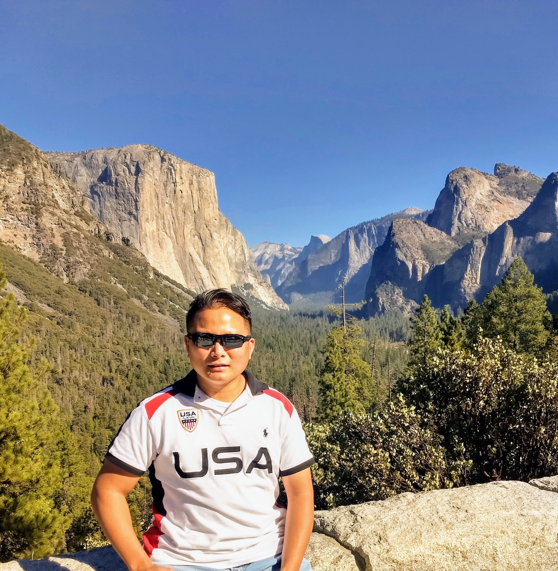
The Yosemite Falls is the most popular and most visited falls at Yosemite National Park. It is formed by creeks tumbling into the Yosemite Valley into the Merced River down below. The water comes from the snow that is above 6,000 feet during winter, creating a reservoir of water. Yosemite Falls is 2,435 feet from the top to the base and the highest falls at Yosemite National Park. The Yosemite Falls is composed of three waterfalls or drops which are the top, middle and bottom falls. The waterfall is at its peak flow in May and the water flowing through the falls usually stops in late summer and fall.

We drove for about 5 hours from San Francisco via US-140 El Portal to Yosemite National Park entrance. We stayed for two days at Yosemite Valley Lodge which is inside the park and about a 10-15 minutes walk to the base of Yosemite Falls. There were a lot of visual signs leading to the upper and lower falls. There is a public restroom available onsite and a shuttle bus stop #6 situated in front of the park. But the Yosemite National Park shuttle bus is currently not in service due to Covid-19 safety restrictions. There were a lot of people wearing masks but it is challenging to practice social distancing due to a large crowd.

When we arrived at the entrance we immediately took a picture of the beautiful Yosemite Falls with the three waterfalls or drops which are visible from a far. When we got to the base or viewing point area of the Yosemite Falls we were mesmerized by the Majestic beauty and the very loud roar from the waterfalls. The view area was crowded with lots of people wearing masks, posing, and taking pictures but it was very challenging to practice social distancing due to large crowds. We took a family picture on the bridge with the Yosemite Falls as our background. Some people were considerate, taking turns in taking a picture.

After the bridge, we merged to the left and proceeded towards the base of the waterfalls to get a closer look and feel the water mist from the bottom of the falls. We had to go through a lot of huge, wet, and slippery granite rocks. We were just wearing regular running shoes which made us slipped through some rocks. We forgot to change into our hiking boots which is highly recommended when going through the slippery rocks to prevent slips and falls. As we got closer to the falls we heard the deafening loud noise from the falls, saw a beautiful rainbow, and was soaked from the water mist coming from the waterfalls. We took lots of pictures and videos closer to the Majestic and beautiful Yosemite Falls.

Overall it was a great experience for us to experience again. It is my daughter’s first experience of visiting Yosemite Falls with all the waterfalls flowing. We also saw a lot of people with their smaller/younger kids on a stroller as the trail is paved and easy.

Tips: Ensure that you pack lots of bottled water to stay hydrated, wear hiking shoes especially when you want to get closer to the bottom of the falls to prevent slips and falls. Wear a waterproof jacket to minimize getting soak and to keep you warm as the weather is unpredictable. Bring a sanitizer to clean your hands after holding on to the slippery rocks, and a small cloth to wipe yourself from the strong mist. Always remember safety first and don’t do anything unsafe or beyond your comfort level. We even pack a first aid kit just in case of an emergency.

Let me know if you have any questions, comments or what you think about Yosemite Falls (lower falls) after your visit in the comments below. And kindly share our family travel blog site with your friends and family. Or even include our travel blog website address when you post your pictures on social media. Have fun and stay safe. Thank you.

The Tides Wharf and Restaurant (Bodega Bay)

Address: 835 Coast Highway 1 Bodega Bay, Ca. 94923

In the early 1960’s the Tides Wharf and Restaurant were made famous by the popular Alfred Hitchcock’s classic movie “The Birds”. The restaurant was used as a backdrop in one of the scenes from the movie. It’s one of the popular restaurants on the Sonoma Coast with an amazing view of Bodega Bay. It’s situated a few steps away from the Inn at the Tides. And it is also famous for its seafood, fish market, and gift shop. It’s a great place to stop for fresh seafood when driving up the coast. The Tides Restaurant is about 1 hour and 30 minutes from San Francisco via US-101 North ( 85 miles) and is open 7 days a week from 8 am-8 pm. Breakfast is served from 8 am-11 am, lunch from 11 am-4 pm, and dinner from 4-8 pm.

Our drive to The Tides Wharf and Restaurant was very fun, scenic, and had a few winding roads. The view of the beautiful Bodega Bay during our travel was well worth the drive. We even stopped by at the famous St. Therese Church and the Potter Schoolhouse from the 1963 Alfred Hitchcock’s horror movie “The Birds”. We arrived at the restaurant around 9 a.m. and parked in front of the restaurant. There were a lot of parking spaces available but can get crowded during weekends or lunchtime. The weather was beautiful and sunny but later became windier in the afternoon.

The restaurant wasn’t too busy since we got there early at 9 am. We were seated inside since the outdoor tables are not available until 11 am. There were 3 of us at our party which includes 1 kid and 2 adults. We ordered fried calamari as appetizer for $8.95, hot crab sandwich for $26.50, 1/2 pound Bodega Bay Burger for $12.95, Filet of Petrale Sole for $26.00. And for dessert we ordered the cheesecake, apple pie with ice cream and lemon meringue. The hot crab sandwich is a grilled open face with jack cheese and tomato grilled while the deluxe burger came with sourdough bread and sautéed onions. The Filet of Petrale Sole is pan fried with lemon butter. All the foods that we ordered were good and delicious especially the dessert.

Overall, we enjoyed our fun brunch experience at the Tides Wharf and Restaurant especially on a sunny day overlooking the beautiful Bodega Bay. It’s a great quick stop spot with good quality food and a great view on your way to the Sonoma Coast.

Tips: There was ample parking in the morning but it gets busy during lunch and dinner. Bring a sweater or jacket as the weather can change quickly to cold and windy since the restaurant is located on the bay. The outdoor tables are usually busy especially during lunchtime and people are waiting for them to become available. We also ordered some crab sandwich to take home from the Fish Market inside the restaurant. They also have a giftshop available onsite and a small Cafe if there is a long line (wait time) at the restaurant. There were a few covered or shaded outdoor tables available near the Cafe for customers. It’s a great place to eat and watch the sunset.

Let me know if you have any questions or what you think about The Tides Wharf and Restaurant after your visit in the comments below. And kindly subscribe, comment, and share our family travel blog site with your friends and family. Or even include our travel blog website address when you post your pictures on social media. Have fun and stay safe. Thank you.